The Ikinariya, established some 300 years ago, is one of Niigata's oldest and most exclusive restaurants. In feudal times, only members of the city's social and business elite were permitted to dine at the Ikinariya. In these egalitarian days, however, anyone (with the requisite funds, of course) may patronize the establishment. While a full-course dinner runs from $175-$260, lunch is a relative bargain at a mere $60-$90. The restaurant has been designated a national cultural treasure.
Sunday, November 25, 2007
The Kanai Photography Museum
Saturday, November 17, 2007
The View from the Street: Part II
The structures pictured comprise Minatopia, the museum complex devoted to Niigata City's history and culture. The topmost photo shows the main museum building, a replica of Niigata City's second generation City Hall, completed in 1922. Below that is the Sumiyoshi Branch of the Daishi (Big Four) Bank, built in 1927 and moved to its present location to make way for a road-widening project. The two structures at bottom are the Old Custom House and its adjacent storehouse. The Custom House is by far the oldest of the group, having been constructed in 1869 to accomodate foreign trade with then newly reopened Japan. Niigata was one of Japan's five treaty ports; each would have had its own custom house to facilitate trade. Niigata's is the only one remaining today, and was used without interruption until 1966.
The View from the Street: Part I
The Misono Catholic Church, the oldest sanctuary of Christian worship in the area, was dedicated in 1927. The stained glass windows were imported from France, while the pipe organ was made in Germany. Below the church is the former Prefectural Assembly Hall. Completed in 1883, it is one of the oldest administrative buildings in the city, second only to the Custom House. It is said that the British parliamentary buildings inspired its design. The bottommost photos show views of the sprawling Ozawa Wholesale Co., whose former premises now serve as the residential apartments of the descendants of the company founder.
Monday, November 5, 2007
Suibara and the Yamabiko Road: Part I
I explored the
Yamabiko Road alone on a recent day off, Don himself having completed the ride on a solo outing earlier this year. The Yamabiko Dori, as it is known, is approximately 5K long. Every 100 meters along its course is a cluster of stone slabs. The slabs are inscribed with poems , many in haiku form, by poets of local as well as international renown, including one by Matsuo Basho, the father of haiku. There are more than 250 inscribed monuments in all! The road climbs to a modest elevation and offers panoramic views of Niigata City, 40k distant.
Suibara and the Yamabiko Road: Part II
The town of Suibara is home to Hyoko Lake, designated in 1954 a protected habitat for migratory birds. Every winter, thousands of swans winter at Hyoko. Though fall migration was far from being in full flight, as it were, over 4,000 swans had already been counted at the lake. During the Meiji era (1867-1912), Suibara was an important outpost of the Emperial administration. The plan shows the administrative compound as it looked over 100 years ago, with a replica of the watchtower that stood beside the main entrance. The structure pictured below was the official residence of the administrator. 


How Much Farther?
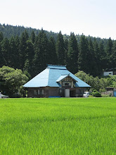
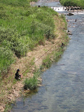
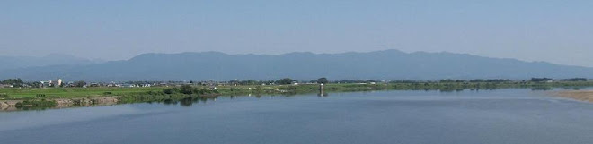
From Honna we followed the Tadami River's broad course along National Route 252. The Tadami, an unnatural emerald green, had no discernable current. Surprisingly, the only indication of life on the Tadami was the clack-clacking of the occasional kingfisher. There were no boaters or fishermen taking advantage of the lovely afternoon. The JR Tadami Line, which runs from Koide, Niigata, to Aizuwakamatsu, Fukushima, derives its name from the river. Like its namesake, there is little activity along the line, there being only five trains daily during the "season"- from December to March service is completely suspended. Though Rt. 252 is paved (blessedly, we felt, after the previous 18k) Don and I had had enough of cycling that day, regardless of road conditions. Some 10k up the road we arrived in Aizu Kawaguchi, and we detoured to the station to consult the timetable. Unsurprisingly, the next train was not due in for nearly 2 hours , so we resigned ourselves to completing the ride as planned. Almost 30k separated us from Nozawa Station, our destination. Unaccountably, considering that we were following the Tadami River downstream, the road parallel to the waterway contained numerous steep climbs. With only a mouthful of Powerbar and a banana between us, the situation was desperate. Don suggested we flag down a passing motorist and offer all our spare cash in exchange for a lift to the station. Meanwhile, we stayed in the saddle, somehow managing to keep going. It seemed to take forever for our computers to register another kilometer traveled, while we ourselves counted down the distance to Nozawa: 25k, 23k, then 20k to go, if our estimate was accurate. Don had nearly reached the limit of his endurance, and one particularly steep pass remained to traverse. Dismount and push, up,up,up-were we on the right road, after all? This climb didn't show on our map. When our computers had clocked kilometer 115 of the 125 we expected to ride that day, the road began its unmistakable, final descent into Nishi-Aizu. We reached the station at 3:30, over 8 hours after leaving Tsugawa. Don's face is expressive of the fatigue and relief we both felt upon finishing-for the first and possibly last time- the Honna-Tsugawa Forest Road ride. 
From the Summit to the Tadami River
We rested and refueled for a good half-hour, Don consuming another of his Powerbars while I polished off the remains of a sandwich. The road at this point was composed of small to medium-sized gravel, and we hoped it would so remain for the ensuing 18k. This was not to be, however, for around the first bend we entered what appeared to be an artillery range. Great ruts, bottomless pits, craters, and high ridges turned all but a kilometer or so of the 18 on the Fukushima side into a bone-jarring, dizzying descent. I found scant comfort in Don's assurance that it would have been "an awesome technical downhill on fully suspended mountain bikes." Inexplicably, there were sporadic paved patches of a few hundred meters' length. But we were going downhill, at least. The scenery on this side seemed less spectacular; admittedly, we may have missed much, insofar as to take the eyes off the road (or the hands off the brakes), was to invite disaster. In any case, we wanted more than anything to get to the bottom of this fiendish road. When we saw the Honna Dam on the Tadami River, we knew we had arrived. 
Saturday, November 3, 2007
The Honna-Tsugawa Forest Road: to the Summit
We finally arrived at the end of Route 227, and from there our proposed route, the Honna-Tsugawa Forest Road, promised cycling at once mysterious and alluring, for our exhaustive Internet searches had yielded little definite or recent information regarding road conditions. However, of one thing we were confident: the scenery awaiting us would more than repay the moderate effort we assumed should be sufficient to take us to the top of the Echigo Range. A sign at the Niigata end informed us that we were 22k from the summit and neighboring Fukushima prefecture. At first the road, which along this stretch had been repaved recently, followed a gentle gradient through a tunnel of towering cedars. As we climbed, the surface deteriorated and the cedars thinned, giving way to deciduous species. Now there were long stretches of gravel, and in places several inches of standing water to be skirted. We were riding in our middle gears now, and at the end of the first hour we had managed to cover about 12k. But the nature of the beast we faced was evident to us. We were almost out of water, and the peaks towered far above us. The next two hours were nightmarish. Our lowest gear often wasn't low enough, and at times we discovered that we could push our bikes up the 10% grade more comfortably and as fast as we could pedal them. The track was occasionally littered with rock and other debris dislodged by recent rains. We prayed the next turning would reveal the summit, and swore under our breath (for we had no breath to spare) when we were inevitably confronted by yet another precipitious climb. Though we did not encounter any other cyclists, we did sometimes discover people who had driven up the mountain (some of them in front- wheel-drive sub-compacts!) to gather chestnuts and mushrooms. Eventually we came upon a trickle of water dripping over a rock face, and we stopped to rest and refill our long-empty bottles. The final 3k to the summit was gravel, and the road deeply pitted and uneven. Finally, after 3 solid hours of climbing, we reached the 1,130 meter "Salt Storehouse" Pass. It was 12:30.
Thursday, November 1, 2007
Wednesday, October 31, 2007
Leg 2: from Tsugawa to the Kamoshika's Domain
From Tsugawa Station we headed almost due south, following national route 49 until we came to prefectural route 227, which would eventually become the Honna-Tsugawa Forest Road. The 1,300 meter peaks of the Echigo Range, which we would have to cross later in the day, were visible only as markings on our maps, for the fog in Tsugawa obliterated all but the nearest objects. After a few kilometers on Rt. 227, we entered Kamikawa Village, and for the next two hours we rode along the Muroya River, past scattered farmhouses, the brown stubble of small rice fields recently harvested, and at one point the lovely wooden classroom building of a defunct elementary school, sad, silent testimony to the slow but inexorable death of rural communities such as Kamikawa. We had the road practically to ourselves, and as the gradient was gentle, it was a most pleasant start to this leg of the journey. A gradual lightening of the atmosphere heralded the lifting of the fog, and by mid-morning we were treated to spectacular views around every road-bend.
Thursday, October 25, 2007
Onward through the Fog
Though a glorious day was breaking as we departed Niitsu, we soon entered a twilight region where everthing save the train itself, the Agano River (whose course the line followed), and the bases of the nearest mountains, was enshrouded in fog, and not a ray of sun penetrated. There was a sense of eeriness and mystery, as though we had entered a world as yet undiscovered. There was also a mundane concern that the fog would turn to rain. An hour or so after pulling out of Niitsu Station, the train pulled into Tsugawa, and we got off.
Friday, October 19, 2007
The First Leg
Tsugawa, formerly a town in its own right but now part of the larger entity Aga City, lies along the banks of the Agano River some 60k east of Niigata City. The first train to Aizu Wakamatsu, with service to Tsugawa, departs not from Niigata but from Niitsu, 25k distant in the direction of Tsugawa. It leaves Niitsu at an unseasonably early 6:06A.M. Don and I knew a long day awaited us (though just how long we never imagined), so we grudgingly agreed to forgo several hours of Sunday slumber to cycle to Niitsu in time to catch the 6:06.
Monday, October 15, 2007
越後 山脈 The Echigo Mountain Range
If one is fortunate enough to possess a map showing it, the Honna-Tsugawa Forest Road appears as the faintest of cartographic lines. On the Niigata side it begins where Rt. 227 ends; thence it heads directly for the wall of peaks forming the Echigo Mountain Range, which comprises the boundary between Niigata and Fukushima prefectures. Snaking its way up Mujinagamori (Badger Forest) Mountain (1315m) and traversing the 1,130m Shionoso (Salt Warehouse) Pass, the track then seems to free-fall into the lap of Honna, a village on the Fukushima side. Was the road passable? Would our bikes, Kona Smokes designed primarily for road use, prove sturdy enough for the rough conditions we would likely encounter? Intrigued rather than deterred, we planned our excursion for Sunday, Oct. 14, and consulted JR's timetables for the earliest train to Tsugawa.
Introductory
Subscribe to:
Posts (Atom)